The Serengeti sits in northern Tanzania, in East Africa, straddling the Mara and Simiyu Regions between roughly 1 and 3 degrees south of the equator and 34 to 36 degrees east, bordered by Lake Victoria to the west and continuing north across the international border into Kenya, where the same ecosystem is known as the Maasai Mara. Understanding the Serengeti’s geography, both the national park’s precise boundaries and the wider ecosystem it sits inside, is the starting point for any trip planning, since the answer to where the park lies also shapes the answer to how a traveller actually reaches it.

Country and Region
Serengeti National Park lies entirely within Tanzania, in the country’s north, roughly midway between the shore of Lake Victoria to the west and the Great Rift Valley escarpment to the east. Administratively, the park falls across parts of the Mara Region in the north and the Simiyu Region in the south, with Arusha Region bordering it to the southeast. The park is bordered by the Ngorongoro Conservation Area to the southeast, the Maswa Game Reserve to the south, the Grumeti and Ikorongo Game Reserves to the west, and, at its northern edge, the international border with Kenya, beyond which the same landscape continues as the Maasai Mara National Reserve.
Where the Name Comes From
The word “Serengeti” derives from the Maasai term “Siringet”, meaning roughly “the place where the land runs on forever” or “endless plains”, a description of the landscape that predates the park’s formal protection by centuries. The Maasai people have inhabited and grazed livestock across parts of this landscape for generations, and the name itself reflects a lived, practical description of the terrain’s openness rather than a term coined for tourism or conservation purposes. This origin is a useful anchor for understanding the region’s scale in human terms, since the name was chosen by people moving across the land on foot and with cattle, for whom the plains’ apparent lack of end was a directly experienced fact of daily life rather than an abstract statistic.
Coordinates and Scale
The park’s centre lies at approximately 2.4 degrees south latitude and 34.6 degrees east longitude. It stretches roughly 160 kilometres from north to south and around 200 kilometres at its widest point from east to west, covering a total area of 14,763 square kilometres, making it comparable in size to Northern Ireland, or to the American states of Connecticut and Rhode Island combined. The wider Serengeti-Mara ecosystem, including the national park plus the Ngorongoro Conservation Area, Maswa, Grumeti, Ikorongo, and the Maasai Mara across the border, covers an estimated 25,000 to 30,000 square kilometres in total.
How Far From Arusha
Arusha, Tanzania’s main safari gateway city and the location of Kilimanjaro International Airport, is the reference point most itineraries are built around. By road, the distance from Arusha to the Serengeti varies depending on which part of the park is the destination: the central Seronera area is roughly 320 to 350 kilometres away, a drive of five to six hours that passes through Lake Manyara National Park and the Ngorongoro Conservation Area en route. The western corridor, around the Grumeti Reserve, is somewhat further, around 400 to 460 kilometres from Arusha, a six to seven hour drive. The northern Serengeti, around Kogatende, is the furthest by road, requiring eight to nine hours to reach the far north of the park. Most visitors travelling to the northern or western zones choose to fly rather than drive the full distance, given the time involved.
How Far From Nairobi and the Kenyan Border
Because the Serengeti ecosystem continues north into Kenya as the Maasai Mara, some visitors approach from Nairobi rather than Arusha, particularly those combining a Kenya and Tanzania safari in one trip. The driving distance from Nairobi to the Serengeti is approximately 395 kilometres to the nearest points, though the road route is longer and generally less direct than travel within Tanzania, and most cross-border itineraries use light aircraft to connect the Maasai Mara directly to Serengeti airstrips such as Kogatende or Lobo, avoiding the border crossing by road entirely. The park’s Bologonja and Klein’s Gates, in the northeast, are the entry points most relevant to travellers connecting from the Kenyan side.
Getting There by Air
Flying is the more time efficient option for most zones beyond central Serengeti. Scheduled light aircraft services connect Arusha Airport and Kilimanjaro International Airport to a network of airstrips inside and around the park, including Seronera in the centre, Kogatende and Lobo in the north, and Grumeti and Kirawira in the west, typically operated by regional carriers flying Cessna Caravan or similar light aircraft on multi-stop routes that pick up and drop off passengers at several airstrips per flight. Flight times from Arusha to Seronera run around 45 minutes to an hour; reaching the northern airstrips near Kogatende takes closer to an hour and a half including intermediate stops.
Where the Serengeti Sits Within the Northern Circuit
The Serengeti forms the far end of Tanzania’s northern safari circuit, the well established route that also includes Tarangire National Park, Lake Manyara National Park, and the Ngorongoro Conservation Area, all reached from Arusha in roughly that order on a typical road itinerary. The Serengeti’s position at the far northwestern end of this circuit, closer to Lake Victoria and the Kenyan border than to Arusha itself, is part of why it requires the longest single travel leg of any northern circuit park, and why many itineraries pair a flight into or out of the Serengeti with a road journey through the closer parks.

Neighbouring Protected Areas
Immediately to the southeast, sharing a boundary with the Serengeti at Naabi Hill, lies the Ngorongoro Conservation Area, home to the Ngorongoro Crater and the Olduvai Gorge archaeological site. To the south, the Maswa Game Reserve extends the protected area further, though it is managed as a separate hunting and photographic concession rather than as national park land. To the west, the Grumeti and Ikorongo Game Reserves form a buffer zone between the national park and the more densely populated area around Lake Victoria, and are themselves home to several private, exclusive use safari concessions. To the north, the international boundary with Kenya separates Serengeti National Park from the Maasai Mara National Reserve in name and in management only; ecologically, wildlife moves across this line constantly and without regard for it.
Common Confusions About the Serengeti’s Location
Several location related misunderstandings come up repeatedly among first-time visitors planning a trip. The most common is treating “the Serengeti” and “the Ngorongoro Crater” as the same place; they are adjacent and often visited on the same itinerary, but the crater is a distinct volcanic caldera within the separately administered Ngorongoro Conservation Area, not a feature inside Serengeti National Park itself.
A second common confusion involves the Maasai Mara, which many travellers assume is simply “the Kenyan part of the Serengeti” in a loose geographic sense; ecologically this is broadly accurate, since both areas sit within the same connected system and share the same migratory wildlife, but administratively they are entirely separate protected areas under different national governments, with different entry procedures, different regulations, and no shared visitor infrastructure connecting them beyond a handful of light aircraft routes and a little used road border crossing.
A third point of confusion is assuming that “Serengeti” refers to a single compact area comparable in scale to smaller reserves elsewhere in Africa; at nearly 15,000 square kilometres for the national park alone, and closer to 30,000 square kilometres including the wider ecosystem, the Serengeti is considerably larger than many entire countries, and treating it as a single point on a map rather than a vast region leads to unrealistic expectations about travel time between different parts of it.
Time Zone and Entry Logistics
Tanzania operates on East Africa Time, three hours ahead of Coordinated Universal Time, year-round, with no daylight saving adjustment. Most international visitors enter Tanzania through Kilimanjaro International Airport, located between Arusha and Moshi, roughly 45 minutes from Arusha town by road, or arrive via Julius Nyerere International Airport in Dar es Salaam and connect onward by domestic flight, a considerably longer routing generally used only when other travel plans require passing through Dar es Salaam first.
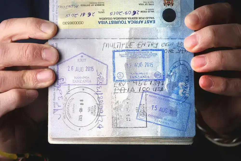
A Tanzanian visa, obtainable in advance online or on arrival for most nationalities, and proof of yellow fever vaccination if arriving from a country with risk of yellow fever transmission, are the standard entry requirements travellers should confirm against current Tanzanian immigration policy before departure, since requirements are set by the government and can change.
Why Location Shapes the Itinerary
The Serengeti’s location, remote from any major city, spread across a vast area, and split administratively from the neighbouring reserves that form part of the same ecological system, is the reason most visits are planned as multi-park itineraries rather than single-destination trips. A traveller arriving in Arusha is rarely visiting the Serengeti alone; the park’s position relative to Ngorongoro, Tarangire, and Lake Manyara means that combining several parks into one road or fly-in circuit is both logistically natural and, for most visitors, the more efficient use of the long travel time the Serengeti’s remoteness otherwise demands. Knowing exactly where the park sits, and how far it is from wherever a trip begins, is therefore not just a geography question but a direct input into how many days a realistic itinerary needs and whether road travel or flying makes more sense for a given budget and timeframe.
For anyone building an itinerary from scratch, the practical sequence is usually to fix the arrival point first, most often Kilimanjaro International Airport, then work outward from there: how many days are available in total, which zone of the Serengeti matches the intended travel dates, and whether the remaining time and budget favour a road circuit through the closer northern circuit parks or a series of shorter flights that trade a higher transport cost for more time actually spent on game drives rather than in transit. The Serengeti’s location, vast, remote, and only fully accessible once this sequence has been worked through, is ultimately less a single answer than a starting point for a series of connected planning decisions.