The Serengeti ecosystem explained in a single sentence is this: it is not a park, but a rainfall driven system of connected land, roughly 25,000 to 30,000 square kilometres in size, that spans two countries and exists because more than a million grazing animals move constantly in search of grass and water. Serengeti National Park, at 14,763 square kilometres, is the core of that system but not the whole of it. Understanding the difference matters for anyone planning a visit, because the wildlife you see, and where you see it, depends on which part of the ecosystem your camp sits inside.
Why “Ecosystem” and Not Just “Park” Is the Right Word
A national park is a legal boundary. An ecosystem is a functional unit defined by what actually happens on the ground: rainfall, soil, grass growth, water availability, and the movement patterns of animals that respond to all four. The Serengeti ecosystem includes the national park itself, the Ngorongoro Conservation Area to the southeast, the Maswa Game Reserve to the southwest, the Grumeti and Ikorongo Game Reserves along the western corridor, the Loliondo Game Controlled Area to the east, and the Maasai Mara National Reserve across the border in Kenya. None of these areas is fenced off from the others. A wildebeest calving on the short grass plains near Ndutu in February has no awareness that it is standing inside the Ngorongoro Conservation Area rather than Serengeti National Park; the animal only knows there is grass, and that is the entire point of thinking about the region as one ecosystem rather than a collection of separately administered parks.
This distinction is practical, not academic. A camp near Kogatende in the northern Serengeti and a camp near Ndutu in the south are both inside “the Serengeti” in the loose sense most people use the word, yet they can offer entirely different wildlife experiences in the same week, because the migration might be concentrated at one and largely absent from the other depending on the month.
The Landscape That Shapes Everything
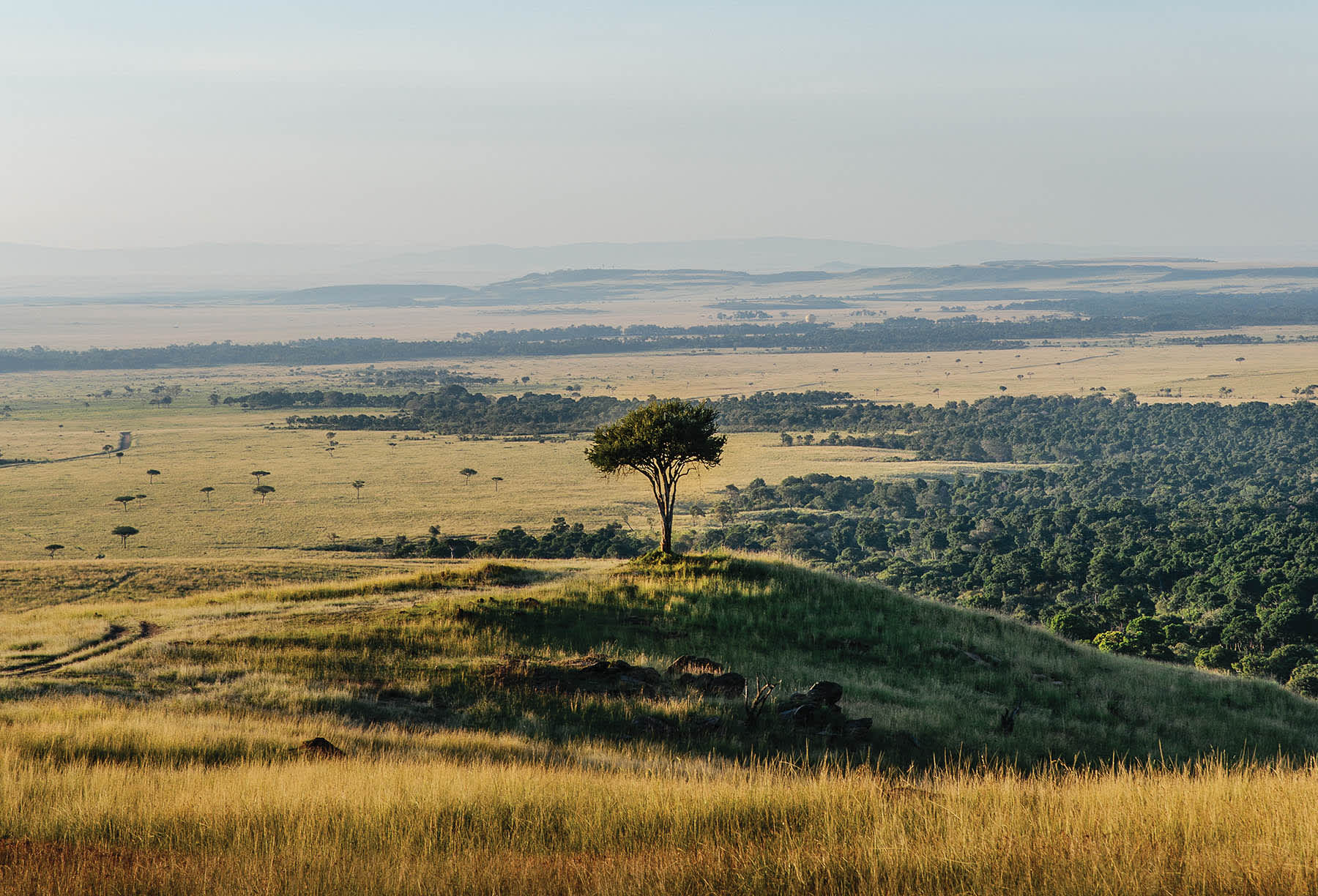
The Serengeti’s terrain was formed by volcanic activity from the Ngorongoro Highlands and, further afield, Kilimanjaro and Mount Meru. Ash deposits from these eruptions settled over the southern and eastern plains over hundreds of thousands of years, creating the short, mineral rich grasses around Ndutu and the Gol Mountains that give the calving grounds their name: the soil there is too shallow and rocky to support trees, so it produces grassland rather than woodland, and that grassland happens to be exceptionally nutritious for lactating wildebeest.
Moving north and west, the soil deepens and the landscape shifts to the wooded savanna of the central Seronera Valley, then to the riverine forest and denser bush of the Grumeti Reserve in the west, and finally to the hillier, more broken terrain of the northern Serengeti around Kogatende and the Lamai Wedge, where granite kopjes, isolated rock outcrops that formed as the surrounding softer rock eroded away, punctuate the grassland and provide shelter for leopards and dens for hyena clans.
Rainfall Is the Engine
Nothing about the ecosystem makes sense without rainfall as the starting point. The southern plains receive short rains from November to December and long rains from March to May, and it is this rainfall, not any human management decision, that determines where the migration’s roughly 1.5 million wildebeest, several hundred thousand zebra, and hundreds of thousands of gazelle will be in any given month. Grass grows fastest where rain has just fallen, and the herds move toward that new growth instinctively. When the southern plains dry out from around April onward, the herds shift toward the permanent water sources of the Grumeti River in the western corridor, then continue north as that water, too, becomes scarcer through the dry season, arriving at the Mara River in the far north by July or August, where the famous crossings take place because the river is the last major obstacle between the herds and the greener, higher rainfall country of the Maasai Mara.
This is why “the Serengeti” cannot be understood as a single static place. It behaves more like a slow, circular tide, and the ecosystem concept exists specifically to describe a region large enough to contain that entire tidal movement within its boundaries, rather than clipping it off at an arbitrary park fence.

What the Ecosystem Supports
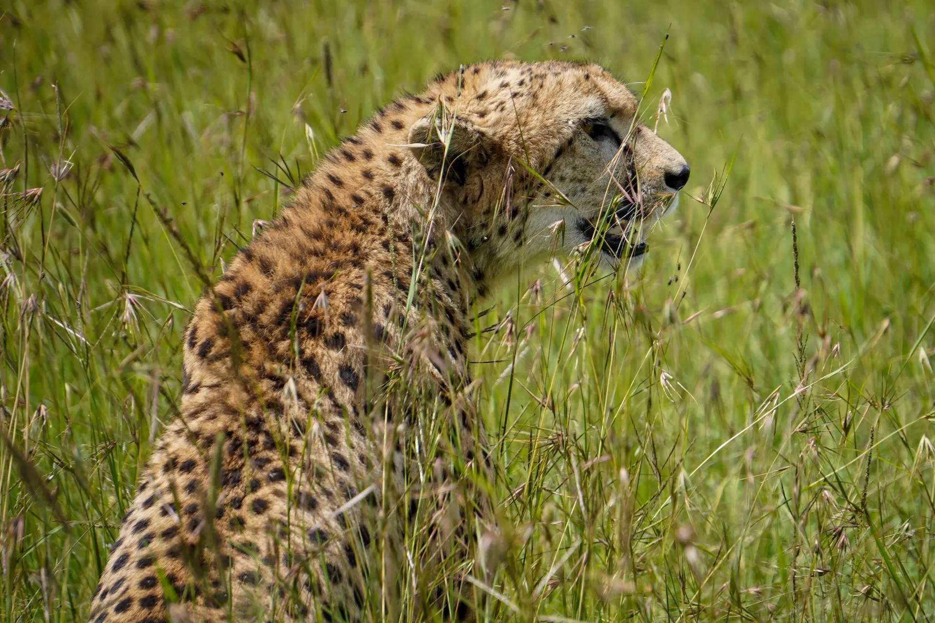
The scale of the Serengeti ecosystem is what makes its predator populations viable. Lion prides need large, defended territories to sustain themselves, and estimates for the lion population across the wider ecosystem run to several thousand individuals, among the largest concentrations of free ranging lions left on the continent. Spotted hyena clans, some of the most heavily studied in the world thanks to decades of research based out of the Serengeti Research Institute near Seronera, number in the thousands as well. Cheetah, which need open sightlines to hunt using speed rather than ambush, are concentrated on the short grass plains of the south and the Serengeti’s central woodland edges, while leopard favour the riverine forest along the Seronera, Grumeti, and Mara rivers, where tree cover gives them somewhere to store a kill away from scavengers.
Beyond the predator-prey dynamic, the ecosystem supports over 500 recorded bird species, more than 100 species of dung beetle that play an underappreciated role in recycling the vast quantity of waste the migration produces, and plant communities ranging from the acacia woodland of the central Serengeti to the riverine forest of the west and the open grassland of the south, each shaped by a combination of rainfall, soil, and grazing pressure that varies across the ecosystem’s roughly 200 kilometre width.
How the Numbers Reached Today’s Scale
The wildebeest population that defines the ecosystem today was not always this large. Rinderpest, a viral cattle disease introduced to East Africa in the 1890s, spread into wild ungulate populations and suppressed wildebeest numbers for decades, keeping the population at roughly 200,000 to 300,000 animals through the early twentieth century. A rinderpest vaccination campaign targeting domestic cattle herds around the ecosystem’s boundary in the early 1960s removed the disease reservoir, and the wildebeest population responded by roughly quintupling over the following two decades, settling at the 1.3 to 1.5 million figure that has held, with annual fluctuation tied to rainfall and disease, since the 1970s. This history matters because it shows the ecosystem’s carrying capacity is not fixed; it responds to specific, identifiable pressures, and the current scale of the migration is itself a comparatively recent ecological event rather than an unchanging constant stretching back into deep history.
Elephant numbers followed a different trajectory. Heavy poaching for ivory through the 1970s and 1980s reduced the ecosystem’s elephant population sharply, from an estimated 3,000 or more animals down to a few hundred by the mid-1980s. Improved anti-poaching enforcement, an international ivory trade ban agreed in 1989, and sustained ranger presence allowed the population to recover substantially over subsequent decades, though estimates still sit below the historical peak.

Research and Long-Term Monitoring
Few ecosystems on earth have been studied as continuously as the Serengeti. The Serengeti Research Institute, established near Seronera in the 1960s and now operating as the Tanzania Wildlife Research Institute’s Serengeti centre, has supported decades of uninterrupted data collection on lion pride dynamics, wildebeest population counts, and predator-prey ratios. Long-running studies of specific lion prides in the Seronera Valley, some tracked across multiple generations, have produced much of what is understood globally about lion social structure, territory defence, and cub survival rates. This unbroken research record is part of why the Serengeti is frequently used as the reference case in broader African conservation science; comparatively few other ecosystems have anything close to the same depth of longitudinal data.
Two Countries, One System
The Serengeti ecosystem does not stop at the Kenya-Tanzania border, even though the two countries manage their respective sections separately, Tanzania through the Tanzania National Parks Authority and the Ngorongoro Conservation Area Authority, Kenya through the Narok County Government for the Maasai Mara National Reserve and a network of private conservancies bordering it. Wildlife crosses the border freely; management decisions do not. This creates real differences a visitor will notice: Tanzania’s national park sections prohibit night driving and off road access, while some of the private conservancies bordering the Maasai Mara permit both. Regulatory differences aside, biologically the two countries are managing halves of the same system, and cooperation between Tanzanian and Kenyan wildlife authorities on cross-border issues, from anti-poaching coordination to disease monitoring in the shared wildlife population, reflects that underlying reality even where park administration does not.
Conservation Status and Ongoing Pressure
The core of the ecosystem was first protected in 1929, with the modern Serengeti National Park established in 1951 and its boundaries expanded over subsequent decades. UNESCO designated the park a World Heritage Site in 1981, recognising both the scale of the migration and the intactness of the predator-prey system as globally significant. That designation has not eliminated pressure on the ecosystem. Human population growth on the boundaries of the protected areas, particularly around the western corridor and the Loliondo area, continues to raise questions about land use, grazing rights, and the space available for wildlife corridors that connect the core park to the surrounding reserves. Poaching, once a severe threat to the ecosystem’s elephant and rhino populations in particular, has been reduced substantially since the 1980s through better funded ranger patrols and cross-border cooperation, though it has not been eliminated. Climate variability affecting rainfall patterns is a newer and less well understood pressure, since the entire system depends on rainfall arriving in roughly its historical seasonal pattern.
What This Means for Planning a Visit
Because the Serengeti is an ecosystem rather than a single park, no camp gives access to “the whole Serengeti” at any one time. A camp in the central Seronera area offers reliable, year-round resident wildlife, lion prides that hold territory there permanently regardless of where the migration currently is, but will not put you at a river crossing in September. A camp near Kogatende in the north puts you close to peak-season crossings from roughly July through October but offers comparatively little in February, when the migration has moved several hundred kilometres south to calve. Understanding the ecosystem as a whole, rather than treating the Serengeti as a single undifferentiated destination, is the single most useful piece of context for deciding where to base a safari and when to travel, since the animals themselves are always somewhere within this connected system, but rarely everywhere within it at once.
It is also worth understanding what the ecosystem is not. It is not a fenced reserve with a fixed animal population that can simply be counted and managed like a large zoo enclosure. Boundaries on a map, the edge of Serengeti National Park, the border of the Ngorongoro Conservation Area, the line separating Tanzania from Kenya, are administrative conveniences layered on top of a landscape that functions as one continuous unit. A visitor who grasps that the ecosystem is defined by rainfall and animal movement rather than by park signage will understand, before even arriving, why the same question, “where is the migration right now”, has a different answer depending on the month, and why two safaris booked six months apart in the same region can look almost nothing alike.